Best of the
Best
Editors' picks and our top buying guides


Best of the
Best
Editors' picks and our top buying guides
Latest

6 Houseplants That Stop Insects From Invading
5 minutes ago
The IRS Is Holding $1 Billion for 940,000 Tax Payers. Here's How to Claim Your Money
5 minutes ago
If Your iPhone Is Stuck on SOS Mode, This Might Be the Fix
5 minutes ago
Xbox Game Pass Ultimate: Play NHL 24 Now, Manor Lords and More Soon
5 minutes ago
Here's How and When to Weigh Yourself for the Most Accurate Measurements
20 minutes ago
Home Loan Rates Increased Over the Last Week: Today's Mortgage Rates for April 23, 2024
29 minutes ago
Refi Rates Increase for Homeowners: Current Refinance Rates on April 23, 2024
32 minutes ago
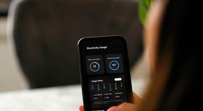
Home Energy Audits: Why They Matter and How to Get One
39 minutes ago
Get a Massive 51% Off These Anker ANC Wireless Earbuds Today
44 minutes ago
Popular AeroPress Coffee Makers Are Available From Just $30 Right Now
48 minutes ago
Huawei's New Phone Uses Satellites for Image Sharing. No Internet Required.
54 minutes ago
Here's What to Do if Your Dog Eats a Cicada
1 hour ago
iOS 17: How to Disable Your iPhone's Annoying Inline Predictive Text
1 hour ago
Best T-Mobile Phones for 2024
1 hour ago
Best Flip Phone for 2024
1 hour agoMore to Explore
Reviews, advice and more from CNET's experts.


Get the best price on everything CNET Shopping helps you get the best prices on your favorite products. Get promo codes and discounts with a single click.
Add to Chrome - it's free!
Our Expertise
Expertise Lindsey Turrentine is executive vice president for content and audience. She has helped shape digital media since digital media was born.
0357911176
02468104
024681024
Featured in
Tech


Upgrade your inbox
Get CNET Insider
From talking fridges to iPhones, our experts are here to help make the world a little less complicated.
Featured in
Money


Crossing the Broadband Divide
Millions of Americans lack access to high-speed internet. Here's how to fix that.


Featured in
Energy and Utilities


Deep Dives
Immerse yourself in our in-depth stories.


Get the best price on everything CNET Shopping helps you get the best prices on your favorite products. Get promo codes and discounts with a single click.
Add to Chrome - it's free!
Featured in
Internet


Sleep Through the Night
Get the best sleep of your life with our expert tips.


Get the best price on everything CNET Shopping helps you get the best prices on your favorite products. Get promo codes and discounts with a single click.
Add to Chrome - it's free!
Tech Tips
Get the most out of your phone with this expert advice.


Get the best price on everything CNET Shopping helps you get the best prices on your favorite products. Get promo codes and discounts with a single click.
Add to Chrome - it's free!

Featured in
Home


Living Off Grid
CNET's Eric Mack has lived off the grid for over three years. Here's what he learned.